
For months, we have warned readers that the probability of El Niño formation was rising, with downstream risks across critical agricultural growing belts. That forecast has now moved from a risk scenario to reality, as the first major weather body has formally declared the onset of this warming pattern in the equatorial Pacific, threatening to disrupt rainfall, temperatures, crop yields, power demand, and commodity flows into year-end.
Bloomberg commodity expert Javier Blas wrote on X, “The Japanese Meteorological Agency becomes the first major weather body to formally call the onset of El Niño phenomenon in the Pacific.”
“It’s the first El Niño in three years, and some forecasters expect it to be one of the strongest ever,” Blas noted.
The Japanese Meteorological Agency becomes the first major weather body to formally call the onset of El Niño phenomenon in the Pacific.
It’s the first El Niño in three years, and some forecaster expect to be one of the strongest ever. https://t.co/v6OlU9mMTu
— Javier Blas (@JavierBlas) June 10, 2026
Our coverage on the El Niño risk:
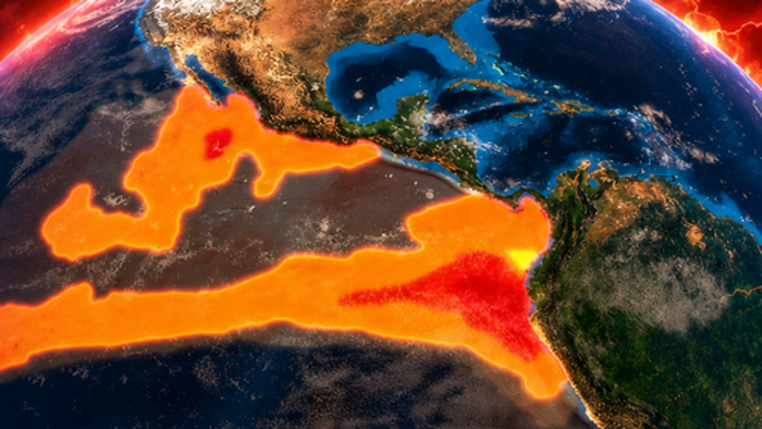
El Niño is driven by unusually warm Pacific waters and can shift rainfall and temperature patterns worldwide. Early impacts are already appearing, including a delayed Indian monsoon and disruptions to Peru’s fishing season. Historically, strong El Niño events have reduced yields for the world’s top agricultural belts.
Already…
Thailand white rice, a regional Asian benchmark, surged 20% in May, the largest monthly increase in data going back to 2008, according to Bloomberg.
Here is the Bloomberg overview of El Niño:
What is El Niño?
El Niño was first observed in the 1600s by Peruvian fishermen, who noticed that Pacific waters were unusually warm around Christmas time in some years. They named this naturally occurring phenomenon “El Niño de Navidad” in reference to the Christ Child.
During El Niño, trade winds that normally blow east-to-west and push warm Pacific water toward Asia begin to weaken or even reverse direction. It’s unclear what triggers this shift, but it results in warm water drifting toward the Americas, heating large parts of the central and eastern Pacific Ocean. The extra warmth changes the atmosphere above the sea. Storm tracks shift and rainfall patterns move.

How often does El Niño occur?
There’s no fixed timetable for when El Niño emerges. It typically appears every two to seven years and varies in strength and duration. The last event was in 2023-2024.
El Niño is part of a larger Pacific climate cycle known as the El Niño-Southern Oscillation, or ENSO. The cycle swings between El Niño, its cooler counterpart La Niña and a neutral phase in between. During La Niña, the east-to-west trade winds become stronger, pushing warm water further west and resulting in a cooler-than-usual eastern Pacific.

The immense size of the Pacific Ocean, which covers around a third of the planet’s surface, gives ENSO an outsized influence on global weather. While similar climate patterns exist in the Atlantic and Indian oceans, they don’t have the same reach. El Niño and La Niña events usually peak between December and January, although their effects can linger for months.
What is a ‘Super El Niño’?
El Niño is identified by monitoring the temperature levels in the Pacific Ocean, most commonly in a region known as Niño 3.4. The threshold for El Niño used by the US National Oceanic and Atmospheric Administration (NOAA), is when the sea surface temperature exceeds the long-term average by at least 0.5C (0.9F) for five consecutive overlapping three-month periods. For a strong El Niño, the temperature difference must be at least 1.5C; for a very strong El Niño it must reach at least 2C.
“Super El Niño” isn’t an official term used by forecasters such as NOAA and the World Meteorological Organization. It’s been popularized this year as a very strong El Niño looks to be on the cards.
Very strong El Niños are rare. There have only been around a handful since 1950 and the last one was in 2015-2016. Severe weather events are more likely to occur when there’s a stronger El Niño, but they’re not guaranteed.

How is the weather affected by El Niño?
The heat that El Niño slowly releases from the Pacific Ocean into the atmosphere often pushes global temperatures to new highs. Scientists expect 2027 to be one of the hottest years on record, potentially dethroning 2024, which came in 1.5C above the pre-industrial average, according to NOAA.
El Niño doesn’t hit every region in the same way. The effects typically materialize in the tropics first, before spreading across Australia, Asia, the Americas and Africa.
Australia, southeast Asia, the northern US and Canada usually become hotter and drier, making them more prone to drought and wildfires. India can experience disruptions to monsoon rainfall. The southern US, Chile, Argentina and parts of East Africa frequently experience wetter conditions and a greater risk of flooding.

The Atlantic hurricane season often becomes quieter during El Niño years because increased wind shear — a sudden change in wind speed or direction — tears apart developing storms. The hurricanes that do form could still be highly destructive, but a lower frequency could reduce the harm to communities and infrastructure and limit disruption to oil and gas assets in the Gulf of Mexico.
There are usually around 14 named Atlantic storms from June through November — storms are given names when their wind speeds reach 39 miles (63 kilometers) per hour. NOAA expects there to be only eight to 14 this time around, in part due to El Niño.
By contrast, typhoon activity across the Pacific tends to increase during El Niño years. The warmer water provides more fuel for these tropical storms, meaning Asia could face increased risk of typhoon damage.
Why do the changes from El Niño matter?
El Niño is one of the world’s most closely watched climate signals because it offers clues about storms, drought risk, crop yields and energy demand months in advance.
Utilities use ENSO forecasts to gauge demand for heating and cooling. Higher temperatures boost electricity consumption for air conditioning. This can strain power grids and trigger blackouts. Less rainfall reduces output from hydroelectric dams.
Commodity traders watch for threats to crops, mining operations, oil and gas production and shipping routes. Drought can lower water levels in the Panama Canal, which connects the Atlantic and Pacific oceans, slowing cargo traffic through one of the world’s busiest shipping bottlenecks.
El Niño can have both positive and negative effects but the global economic losses have historically outweighed the regional benefits. Scientists at Dartmouth College looked at the lingering five-year fallout from El Niños and estimated that the 1997-1998 event led to $5.7 trillion in lost gross domestic product globally.
How does El Niño affect food production?
Some crops benefit from El Niño. Higher rainfall in California, for example, is good for avocado and almond yields. However, many staples, including rice, wheat, palm oil, coffee and sugar, are produced in areas likely to face drier and hotter conditions.
Beyond the impact on land, El Niño can disrupt ocean fisheries. The warm Pacific water flowing eastward keeps a lid on cooler, nutrient-rich water ascending to the sea surface, resulting in fewer phytoplankton for fish to eat. Some fish, such as anchovies off the coast of Peru, may seek cooler, deeper water, making them harder to catch, while tropical species may venture to areas that are normally too cold.
Lower crop harvests, smaller fishing hauls and livestock casualties from extreme weather can threaten global food security and push up prices.
The reason the El Niño weather pattern is drawing so much concern is that weather shocks can directly impact agricultural yields, tighten food supplies, and send prices higher. That risk is emerging at the same time energy shocks from the Gulf are already lifting inflation expectations (read here). If food prices begin to accelerate on top of higher energy costs, the result could be a renewed inflationary period in the latter half of the year.