Milton weakened overnight to a Category 4 hurricane. The storm is an “extremely dangerous” threat as it churns near the Yucatan Peninsula, barreling toward Florida’s Gulf Coast this AM, with landfall impacts expected on Wednseday night or early Thursday morning.
According to the National Hurricane Center’s 0500 ET update, Milton was downgraded from a Cat. 5 to Cat. 4, with maximum winds up to 155 mph while traversing the warm waters of the Gulf of Mexico at 12 mph with an east-northeast heading.
The latest storm data shows Milton is completing an eyewall replacement cycle. This means the strongest winds extend further out from the center as the eye grows in size.
Hurricane Milton has weakened by 30 mb over the last 5 hours due to eye wall replacement. Wow. pic.twitter.com/mQKqvfIwqM
— Max Velocity (@MaxVelocityWX) October 8, 2024
The Weather Channel’s Jim Cantore warned on X, “Focus on the surge NOT the category!”
Focus on the surge NOT the category! https://t.co/0nf1ZCtLwD
— Jim Cantore (@JimCantore) October 8, 2024
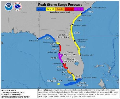
NHC’s peak storm surge forecast shows Milton could generate a wall of water as high as 15 feet across Tampa Bay, Sarasota, and Venice.

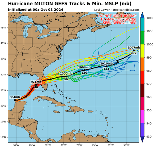
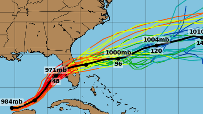
Computer models are shifting south with landfall impacts from Sarasota to Port Charlotte instead of the initial forecasts for Tampa.
#Milton – southward trends in the overnight ECMWF guidance…
The ensemble system has exhibited a southerly trend overnight, bringing the most likely track (black line) closer to Sarasota – this would expose Sarasota and Port Charlotte to the worst of the storm surge.
There’s… pic.twitter.com/QPdYmnN0WD
— Ben Noll (@BenNollWeather) October 8, 2024
More trajectory models.

On Sunday, Florida launched the largest evacuation since Hurricane Irma in 2017. Hurricane warnings have been posted for the region.
Loading…


